Overview & Map
Category: Easy woodland and meadow trail.
Start: Trailhead at the parking area on River Road.
Distance: About 1 mile depending on choice of trails.
Approximate time: 1 hour.
Parking: Parking area at 274 River Road.
A Gift of Extraordinary Generosity
274 River Rd, Madison, CT 06443
Click the red flag above to locate trailhead parking
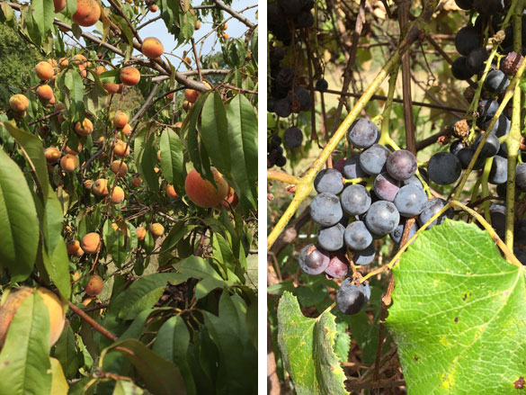
The Rettich Preserve was donated to the Land Trust by Fred and Rosa Rettich in 2014. Fred’s parents, Frank and Anna Rettich, purchased the land in 1906, after emigrating from Germany. For more than 100 years the property was a single-family working farm. Fred and Rosa kept a garden, fruit trees, grapes, chickens, and a few milk cows. They had a large hay field. Over the years, they added various structures, including corn cribs, a cow shed, and chicken coops.
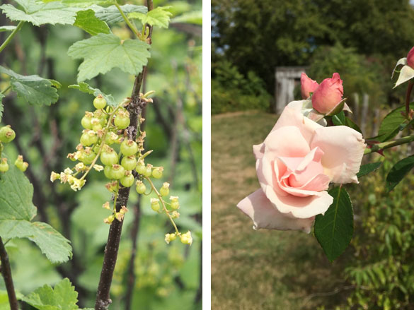
The Rettichs had no children and didn’t want their beautiful, riverside farm to be broken up by developers. It was their vision to preserve the land as open space for future generations.
All of us who live in or near Madison are the lucky recipients of this incredible gift. Exploring this land is like pulling off the wrapping paper bit by bit, and discovering one treasure after another.” Mike Maloney — former MLCT President
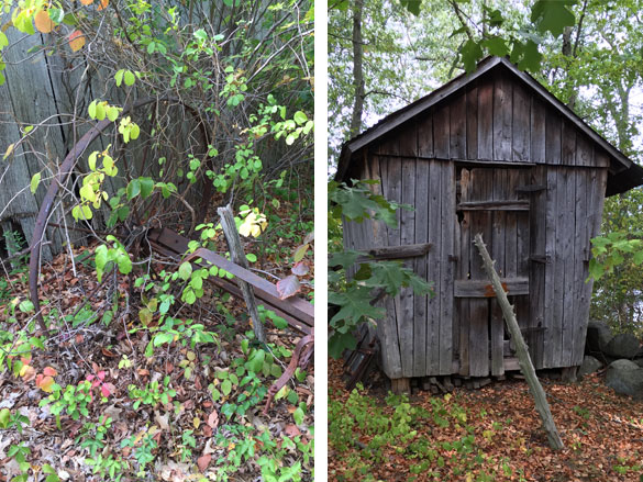
With your help, we’ve prepared the property for public use and conservation. Volunteers have cleared the land of unsafe buildings, debris and chemical hazards. And we have begun to restore vegetation to its natural state by clearing invasive plant species and allowing the fields to rest. Walking trails are in place for public enjoyment. And efforts are underway to attract VIP visitors – barn owls, bluebirds and pollinator species.
All of this is made possible through the hard work of volunteers and your generous donations – as a private organization we do not receive state or town funding. There is still much to do to keep the Rettich Preserve open to the public.
To get involved, contact us at volunteers@madisonlandtrust.org
Trails on the preserve
Pull into the driveway off of River Road, past the Rettich Preserve sign on your left and park on the gravel driveway.
Look to your left (north to the sound of the Railroad trains and cars on Interstate 95) and also the Hammonasset River. You’ll find the stone fence with a plaque placed on a rock – a dedication to Fred and Rosa Rettich, who donated the land to the Madison Land Conservation Trust.
Just fifteen feet to the right of the plaque is a small break in the stone wall, where you can begin walking a pathway that will take you on a looping trail of the 11 acre property. It will take 25 to 35 minutes of leisurely walking, if you pay attention to the details and features of this property.
The land gently rolls along near the Hammonasset River, a former farmland which includes hay fields, second growth woodlands, barns, sheds, fruit trees, grape vines and farm implements scattered throughout.
Red cedar posts remain along portions of the stone walls: barbed wire long gone or removed, except for a few bits here and there. They bound the edge between actively homesteaded areas and the sheltering light woodlands. Woodlands filled with 30 or more types of native trees and various shrubs, and unfortunately accompanied by a few invasive non native plants as well. For example: Tree of Heaven, Burning bush, Bittersweet vines, Multiflora rose, Russian olive and Japanese Honeysuckle.
Stay to the riverside trail, and look over towards the sounds of the Interstate 95. Two unusual trees found on the slope include the Tree of Heaven (invasive) and a Hackberry Tree (Celtis occurentalis) native. Hackberrry is very uncommonly found on the coastal shores of Connecticut.
Black cherry and Red Maple trees grow in between the rocks of the stone wall as you gently descend the wood chipper path. Soon you’ll see three old apple trees on your right on the edge of the northern grassy meadow. Poison ivy is growing on them so be aware!! The path turns gently to the right to reach two large trees located near the base of a knoll: Red Oak and American Sycamore. These trees are too large to wrap your arms around them. The oak is on the left and Sycamore on the right. Also in this are are smaller trees which include black cherry, white oak, red maple and sugar maple. Note the sapsucker woodpecker holes drilled into the apple trees.
Just before you reach the middle meadow, see if you can find the Paper Mulberry tree growing on the right. The birds eat these edible fruits.
Enter the middle meadow and listen and watch for bluebirds in their wood boxes or sitting on the hay rake resting in the middle of the field.
Ducks, geese, and osprey may fly along the Hammonasset River on your left. Check the river surface and look for trout, alewife or shad fish jumping out of the water to catch insects.
The grass path curves along the river to the right. Just by the tripod of red cedar poles, along the edge of the marsh is a Blackgum tree (Nyssa sylvatica): a fruitful tree bearing blue black fruits in late September, available for migrating birds and locals as well.
Freshwater cattails emerge just below the stone wall. Here you might listen for the call of the red winged blackbird in early spring, a sign that winter is over.
As you make your way up a small rise, the grass path curves to your left, before you turn into the third meadow area. Pass the ditch, which conveys water to the river from the Locust grove (trees that grow up near River Road in a dense thicket)
Cross the low boardwalk, to navigate the spring flow from the hillside. Jewelweed, sedges and rushes are growing here in this wetland seep.
Follow into the third meadow and note the forest re-emerging on the left side. The oak trees are reclaiming the farm field where the grasses haven’t been cut on an annual basis. Pause at the wooden bench: the oak trees harbor much bird life along with squirrels, chipmunks and a random woodpecker.
Up a slight hill, past a bluebird house in the field you may spy two fruiting shrubs: a blueberry and a winterberry; summer and winter food for birds; blue for summer, red for winter
Leave the field, pass the corn crib and enter the woodland through the break in the low stone wall. Take the trail to the left: this is a loop trail, with a couple of minor connections in the middle of this lightly wooded area. If you choose to exit to the road or shorten your walk, take the middle lesser used trail.
Rocky outcrops of Madison Gneiss and schist are found on your right; perhaps quarried at some point for local foundation stones. Trees of oak, pine, cedar, maple, and cherry compete for light, space, water and nutrients in this mixed deciduous woodland.
Walk some 100 feet from the corn crib and note on your right a brushy opening of Russian olive trees, and small oaks. This are was probably clear of trees some 15 to 20 years ago and was a minor meadow, due to the exposure of rocky outcrops. Stay to the left and follow to a view point overlooking the Hammonasset River.
To get to the overlook, take the left fork. The view is of the Hammonasset River, looking easterly and southerly, showing vast expanses of marshes dominated by Phragmites reed grasses.
Retrace your steps and turn a quick left at the fork. You’ll continue on the loop, towards the only white birch tree growing in the woods. It has striking white bark.
Around some curves to the left again, you spot an old abandoned rusting vehicle. Greenbrier and honeysuckle vines cover this hulk of metal in summertime so you may have to look hard for it.
Follow the path as it turns right: the left fork turns to exit out to River Road.
The trail winds like a snake ahead, through an amalgam of boulders, until you reach an exposed table of bedrock. Look for a leaning flat topped boulder perched on the top of the bedrock. You ponder: is this a natural break of the stone or one created by humans chipping and pounding on the rock to create a natural seat or table.
Pass the old barn materials (metal roofing and wooden beams and planks) and turn right to exit the woods.
At the corn crib, turn left towards the River Road and walk towards the street. Just 20 feet before reaching the street, gaze to your right and find the stone foundation remains. This foundation may have supported a small garage or storage shed some time ago.
Leave the foundation and follow along the Locust grove, down across the gulley and towards the barns. Keep the meadow on your right and the tree line on your left. Look for trees of Black Walnut, Hackberry, Sugar Maple, and Black Cherry.
Walk past the smallest shed on the Preserve, to the north, or towards the parking lot. Ahead of you will be rows of grape vines and a squared off area of fruit trees, lilacs and fruiting shrubs.
Return now to the parking area. You have completed just one visit to this changing landscape.
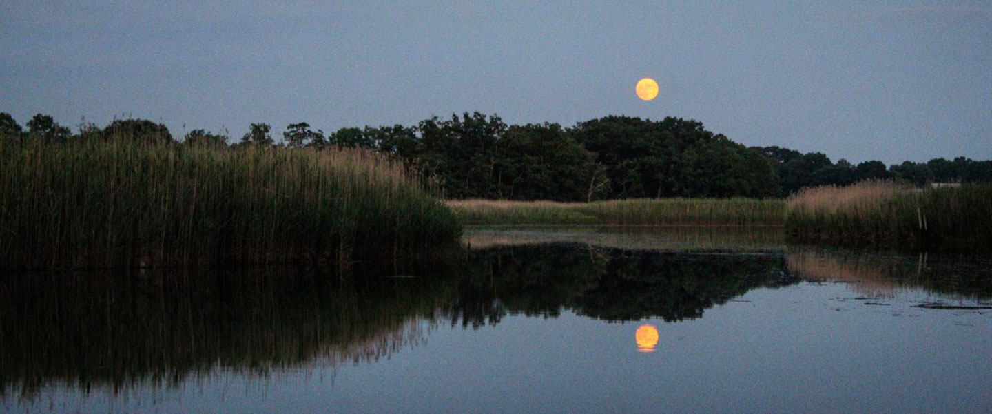
PLEASE NOTE: Hunting, camping, fires, cutting trees or vegetation, horses, and motorized vehicles are all prohibited on Madison Land Conservation Trust property. MLCT trails and properties are for hiking only. Dogs are allowed, but must be leashed. Please pick up all animal waste.
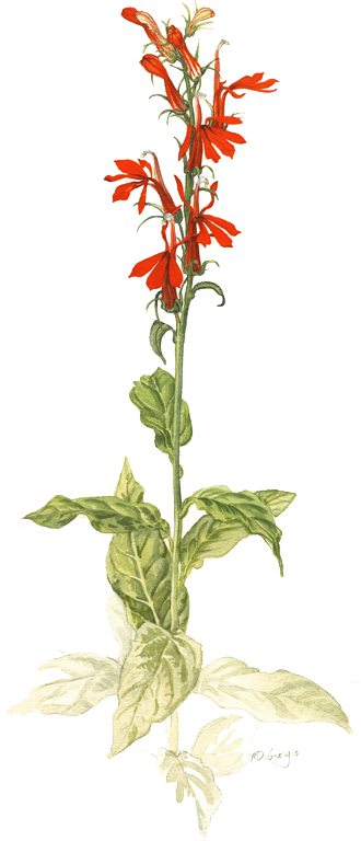
Cardinal Flower
The brilliant red cardinal flower gets its name from the bright red robes worn by Roman Catholic cardinals. They grow up to 3 feet tall and the showy red flowers bloom from July to September in Connecticut. Their flowers are pollinated by hummingbirds and are also a favorite of butterflies. It loves to have its feet wet so you'll find it along streams, rivers and pond edges. Cardinal flower is a native of the Americas and can be found Canada south through the eastern US.
Painting © Michael DiGiorgio

